
I’d made no plans for today in case my COVID booster shot knocked me flat on my butt. Fortunately it didn’t, just gave me a sore arm, so I was able to get stuff done. Before yesterday’s adventure I exchanged my propane tank, so I started by strapping it in, hooking it up, and testing my heater. It worked perfectly. I’ve survived 40° nights without it — thanks to the insulation I didn’t get colder than high 50s inside — but now I’m ready for even cooler desert nights in Arizona. I also replaced a discolored hose for my faucet with a more rigid tube I found behind the jump seat while replacing the propane tank. Really all that’s left is running all my dishes through Carolyn’s dishwasher because I can, general straightening up, and packing everything from the house back into the van. I could be ready to leave tomorrow.
Reuben brought over coffee and confections, and I plugged my FIXD scanner into his car to find out why the check engine light is on. I gave him the specific codes and explanations for catalyst and evap problems. California is mean about emissions testing, which I can relate to from living in Massachusetts and New Hampshire, which also have it. Hopefully the info I got him helps. He suggested waiting until Tuesday to leave, because people would still be clogging the roads tomorrow heading back home from San Diego. Once again, I trust the local guide, so I’m officially planning to head to Quartzite on Tuesday.
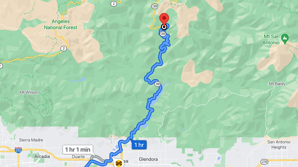
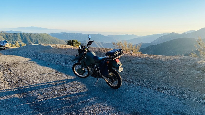
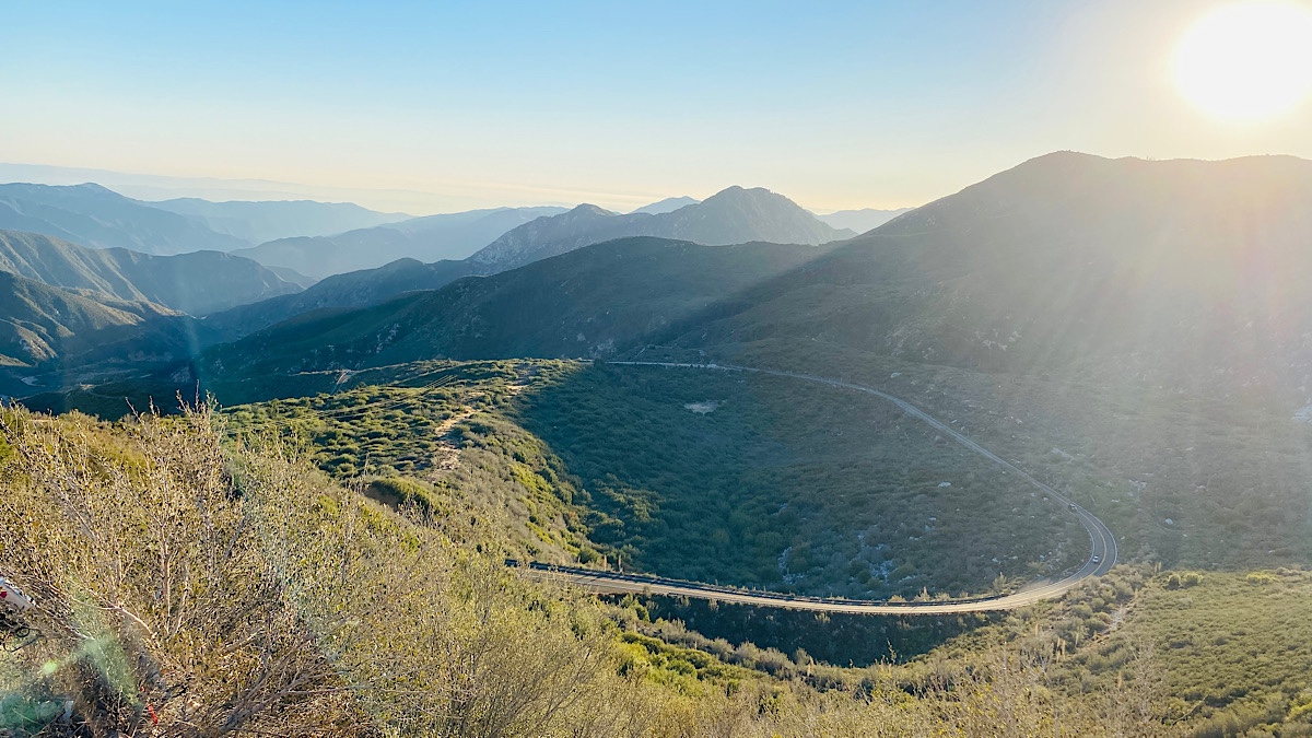
The weather was beautiful (as usual in Southern California), and I wanted to take a bike ride. I hadn’t in a few days, and I could take care of some final packing and prep tomorrow, since I’m not leaving yet. I hadn’t gotten to check out one of the nearby canyon roads yet, San Gabriel Canyon Road north from Azusa. I knew it was closed at some point before intersecting with Angeles Crest, but I wanted to go see how far I could get. Rather than Carolyn’s Harley Sportster, I took my KLR650, now a fully armed and operational battle station.
The ride out to Azusa was easy, despite having accidentally left the “avoid highways” option selected on my Garmin. Traffic was relatively light. On the video about his cross country ride on an old Honda Silverwing (just like I used to have) after IMS Outdoors last week, Shadetree Surgeon remarked on how cool it is to see mountains in the distance, ride a little while, and then find yourself in those mountains yourself. (He’s from Florida, so he’s not used to hills and stuff.) This came to mind as I experienced the same phenomenon myself, heading north from Azusa into the mountains I’d been watching my whole trip out there. He may be a flatlander swamp wizard, but he’s right — it is pretty cool.
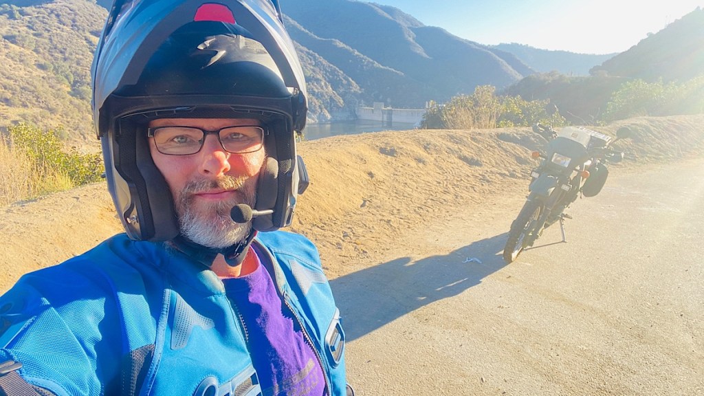
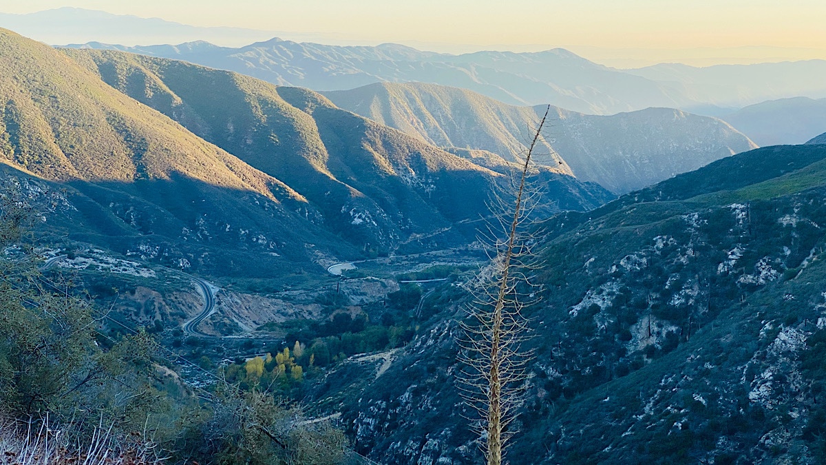
Stopping at the Morris Reservoir Dam reminded me just how tenuous the area’s water situation is. The reservoir is quite low. California seems to be in a perpetual drought, which helps cause these wildfires. I can see why — it hasn’t rained a single day I’ve been here over the past month.

I got into a good rhythm. While I didn’t go quite as quick as I might on the Harley because of my knobby tires, I still pushed a brisk but safe pace through the twists, turns, and hills. I passed an off-road recreational vehicle area, one that allowed Jeeps and other larger vehicles out there. The signs said access was by reservation only, and I was unprepared to hit the dirt. Wouldn’t it be fun, though, to go both canyon carving and off-roading, on the same bike on the same ride? That is now high on my list of things to do when I come back to LA. (Yes, I said it. I like this place enough to visit again sometime.)
To my surprise, while pondering the awesome dual-purpose nature of my KLR650, I caught up with another KLR650. I didn’t always stay caught up. It was clear he knew the road better than me, but he wasn’t using the full width of the lane to take the racing line through the turns like I did, so I could catch back up. We both pulled off at one point and talked a bit. He confirmed that I’d be able to take my bike off-roading in the designated area. We talked KLRs for a while, and then he headed back home to Azusa. I continued north to see how far I was allowed to go.

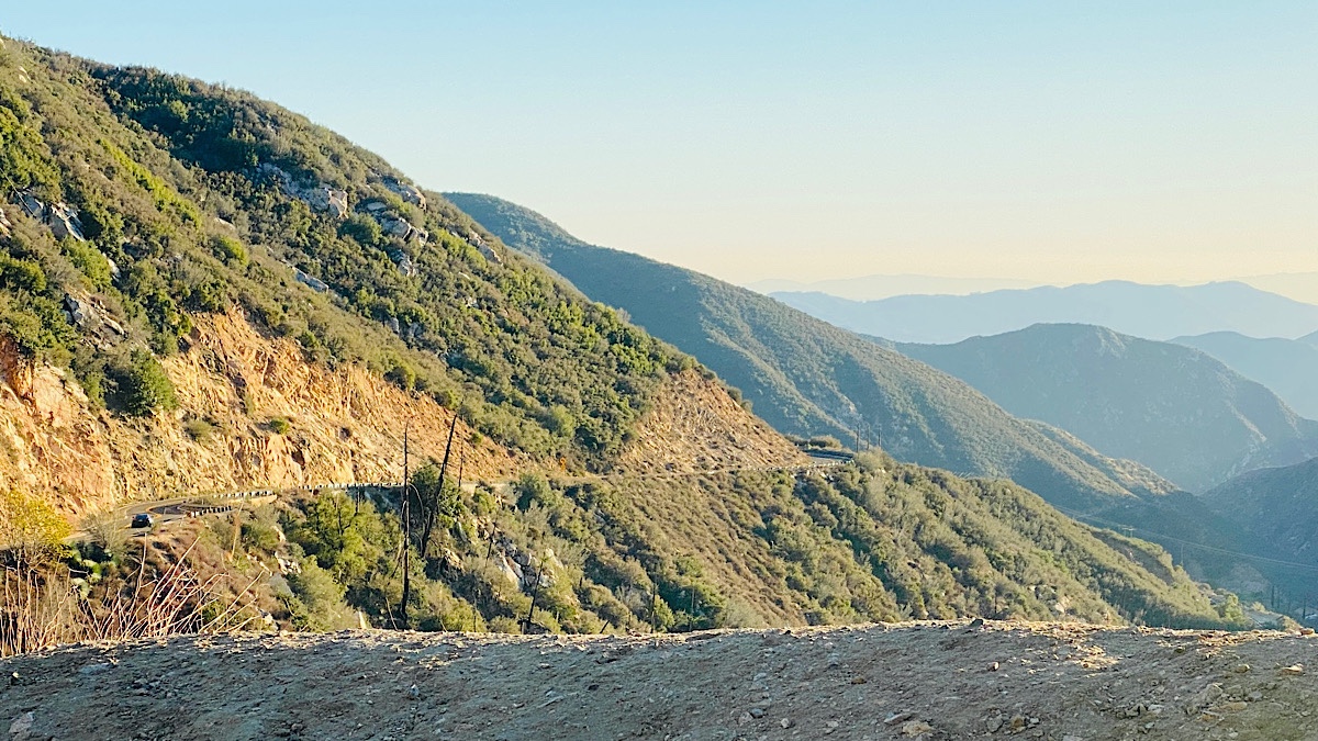
As it turns out, I could go most of the way. Wildfires north of here led to dead trees no longer holding the soil together, resulting in landslides. At this point the road itself is unstable, and permanently closed. This would’ve made an excellent loop around Angeles Crest, but no more. There were only a few signs of fire as far as I was allowed to go.

What a ride, though. It tops out around 5,100 feet, and you can feel the temperature drop. I’ve always said that the best motorcycle roads are the ones that look like a toddler scribbled all over the map. That’s exactly what the pink line on my Garmin looked like, and it really was that good.


The ride back down was just as fun. At one point I had to reduce my pace a bit to let the front brake cool off, as it had lost what little stopping power it had in the first place. This hadn’t even happened on the track! Note to self: remove the dirt cover from the front brake next time to improve airflow.
This time, since it was getting dark, I took the highway back to Carolyn’s. Amazingly, there wasn’t a single traffic backup, letting me maintain a steady 65 in the right lane all the way. Only at the Garfield Avenue exit did traffic slow down, where I was exiting anyway. It was a good time. My only regret is not trying this road — and off-road — out sooner.
