

For a long time, I’ve believed that some of the most fun roads to travel are the ones that run alongside rivers and streams. This has once again proven to be true. I hopped in the Civic once again with Darryl and Marilyn, who drove me up the Columbia River.
We hopped on I-84 from its western terminus with I-5. I’m quite familiar with the eastern end of I-84 in Massachusetts, where it intersects with I-90 back in my old stomping grounds. I-84 is pretty lousy through most of Connecticut, going through the center of Hartford and into New York state. The west end, however, is much better. Traffic isn’t bad, and once it starts running alongside the Columbia River it’s downright beautiful. Soon, though, we bailed off onto Historic U.S. 30, which was much more fun than the interstate.
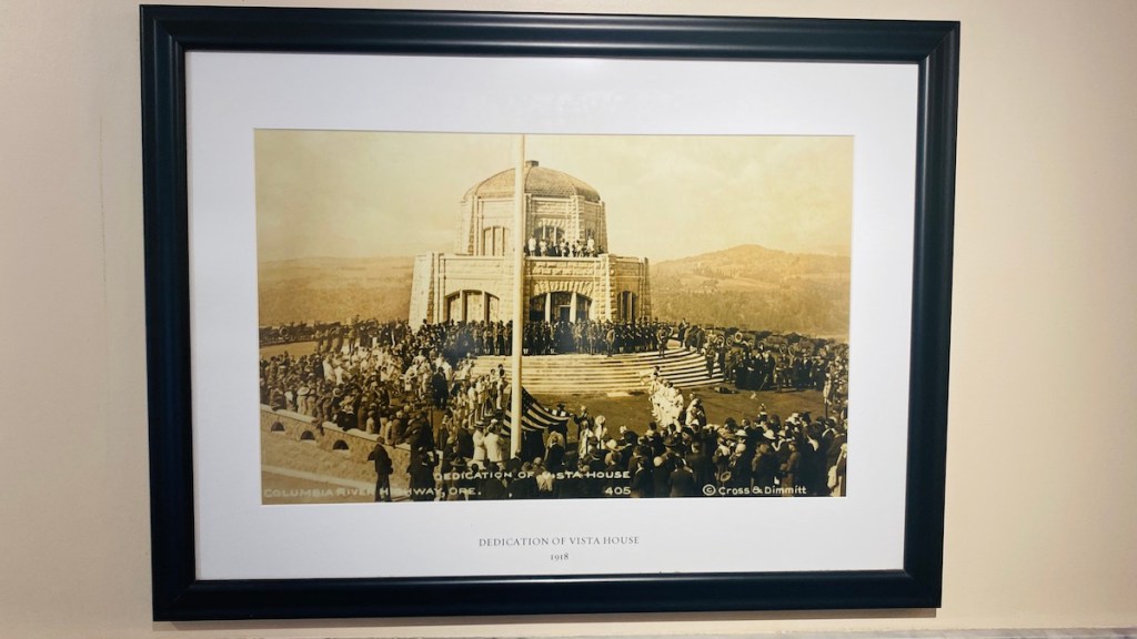

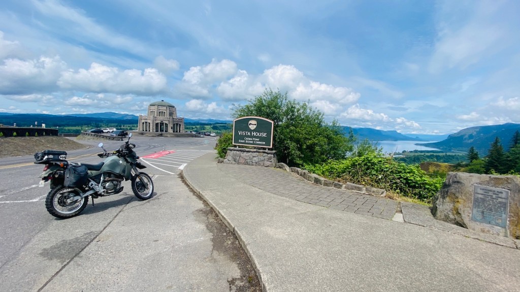
Our first stop was the Vista House, named for the absolutely amazing view it provides over the Columbia River.


The crazy part is this is just the beginning!


The road twists and turns through lush green forests. Before long, I decided I needed to return and ride this on my motorcycle. For now, though, I just sat back and enjoyed the ride, as well as the chance to actually look at the scenery instead of keeping the vehicle on the road.

There’s plenty to see besides the road itself. This area has numerous waterfalls, which makes sense considering the steep drops down to the river. This is Bridal Veil Falls. It requires a little bit of a hike to go see, but it’s well worth it. If you’re not up for a hike, there are still many waterfalls either right next to or a short walk from the road. We stopped at several of these. The most famous one is Multnomah Falls, but we didn’t get to stop because the parking lot was completely full. We pressed on and still saw quite a few rather impressive waterfalls along the way.
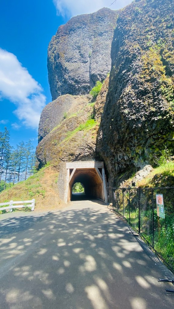

Another neat stop is the Oneonta Tunnel. The main road used to go through here, but it was moved, and the tunnel was filled in for many years. More recently it was hollowed out again and restored to look like it would have 100 years ago back when it was in use. You can’t drive through here, but you can walk and bike.
We followed Historic U.S. 30 until it merged back into I-84. A few miles down the road we exited for our next stop, the Bonneville Dam.

This facility consists of two power-generating dams, one finished in 1938 and the second added in 1981, as well as a lock to let boats through. We’d wanted to take the tour of the original powerhouse, but they closed four minutes before we arrived. Quite literally, 4:04 — not found.
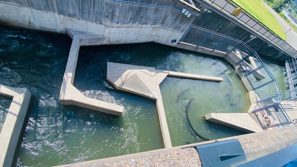
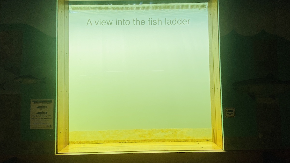
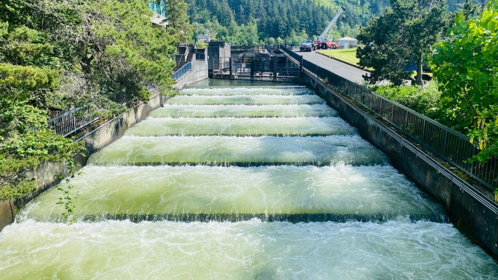
One big problem with dams is that they block fish from reaching their spawning grounds, but Bonneville has an extensive “fish ladder” system that enables them to swim around the dam and continue up the river. The visitor’s center has an underwater fish viewing area, but unfortunately, there wasn’t much to see while we were there.
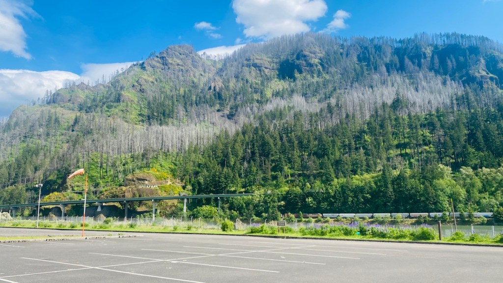
From the parking lot, as well as all around this section of the river, there are vast swaths of forest with dead trees. These are the scars of a forest fire a few years ago that started with some kids playing with a smoke bomb, according to Darryl. It’s scary to see the signs of just how close the fire got to this power plant, as well as nearby towns. Darryl says it spread so quickly it was a struggle to stop it from jumping across the Columbia River over to Washington, never mind keeping it away from I-84 on the Oregon side.
A few more miles down the highway we got off I-84 for the last time in Cascade Locks and got ice cream because all great journeys should include ice cream. There are several nice-looking brewpubs in town as well.
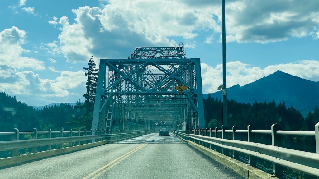
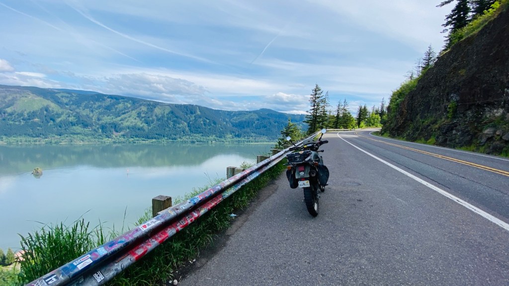
After our tasty frozen treat, we crossed the Bridge of the Gods (for a $2 toll) to return to Washington. We picked up Highway 14 and turned east, back toward Vancouver. Unlike the Oregon side, this road was fast and flowing, with wide sweeping turns instead of narrow tight ones. Both roads are fun in their own way.

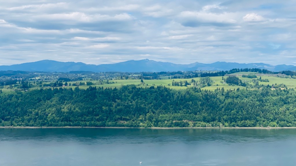
We stopped at an overlook at Cape Horn. With a view like this, you just have to.

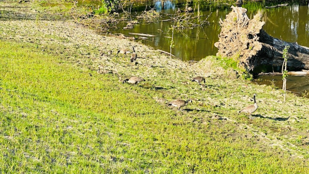
Our last stop was Steigerwald Lake National Wildlife Refuge. It had been closed for renovation for a while but seems to have recently reopened, so we stopped and took a walk. We saw many different kinds of birds, plus several flocks of Canadian Geese. Contrary to their usual behavior, they were actually quite polite. These flocks contained all ages of geese, and it was interesting to see how their appearance changes as they grow up. Finally, we went back to the car and went home.
A few days later, I took an afternoon to follow through on my threat/promise to repeat this loop on my motorcycle. The next few days were supposed to be rainy, so this was my last chance. Unlike our first trip, I didn’t make many stops along the way to sightsee. We’d already done that. This time was all about the ride.
Although it had only been a few days since my last trip, the U.S. Forest Service had started a permit system to limit traffic into and around the waterfall area of the highway. Marilyn had warned me about this and sent me a link to where I could get a permit online. It was only $2, so I bought one while stopped at the Vista House. The ranger who stopped me seemed pleasantly surprised that I was prepared for this, and was happy to scan the QR code on my phone and send me on my way. The highway was quite fun on the bike. This wasn’t a speed run, but it was enjoyable to link multiple corners together in the optimum line through them while remaining in my narrow lane. But there was one place I decided to stop that we hadn’t been able to before: Multnomah Falls.
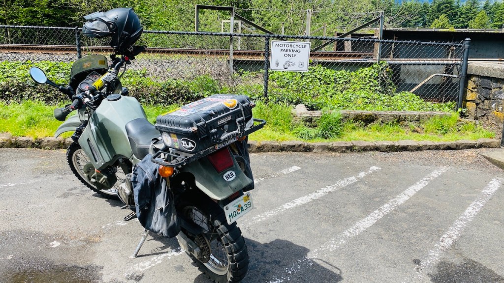
This was the right decision. In fact, even though the parking lot was once again jam-packed, I was able to take advantage of the dedicated motorcycle parking area. I was the only bike there.

This is the Big Kahuna of the waterfalls in the Columbia River Gorge. It has two levels, the top of which drops 542 feet to a small pool, after which there’s a second drop of 69 feet (nice).
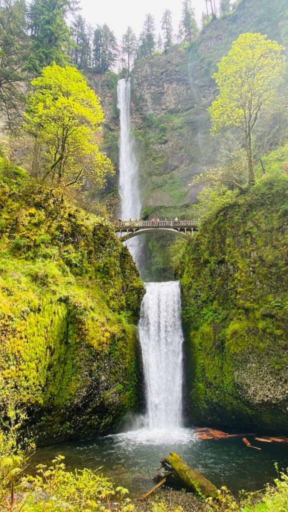
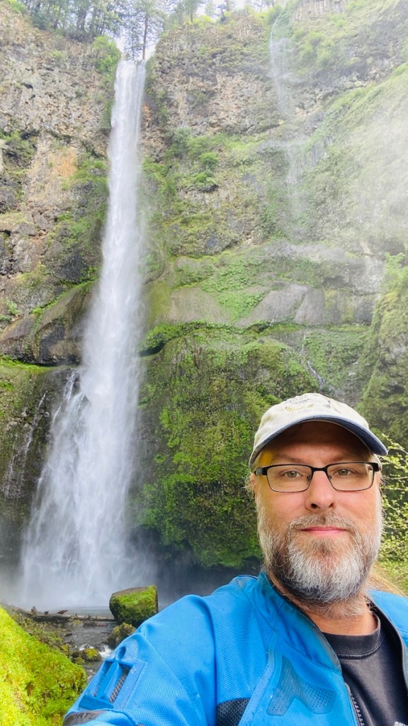
It’s truly an amazing sight to see. I’m glad I came back and stopped to see it. You can see the full falls in just a short, easy walk from the parking lot. There’s a quarter-mile somewhat steep but paved climb to the bridge that goes across the lower level. I’m glad I took that hike. There was a wedding party milling around the bridge while I was there. I didn’t get in their way, but still managed to look around and get “the shot.” I’m quite impressed that the bride managed to walk all the way up there in her wedding gown.
Then it was on to Cascade Locks, another ice cream, and a ride over the Bridge of the Gods. The toll was only $1 for my motorcycle. I did not enjoy the crossing. The height bothered me, and on top of that my tires squirmed on the metal grate road surface. I looked as far ahead as I could, wished traffic would go a bit faster so my bike would be more stable, and made it across safely. I turned left on Highway 14 back toward Vancouver.

Naturally, I had to stop for photos at Cape Horn again. I also took a short detour down Cape Horn Road, which brought me through the field far below the overlook. Unfortunately, it’s a dead-end with no view of the water, which is why I didn’t bother taking any more pictures.
From here, it was an uneventful ride back to Darryl and Marylin’s. I put the bike away in the trailer, likely for the next few days with the rain in the forecast. But that’s not the only bike adventure I’ve had here…
