

The only plan I had was to leave the Rio Grande Gorge rest area (24-hour stop only) and make a detour off my Santa Fe route to visit Los Alamos. I stumbled into touring the world’s first nuclear power plant completely by accident, but this part of my atomic history tour is intentional. During World War II, the US government bought a ranch in this area and turned it into a top-secret, self-contained town for our best and brightest scientists to develop the atomic bomb. Today the town is open to the public like any other town, and I wanted to visit some of the historic sights.
First, though, I had to get there. I’d picked out a dispersed camping area in the Santa Fe National Forest, just to the west side of town. Since I came in from the east, I did a quick driving tour through Los Alamos on the way. Google Maps, in its infinite wisdom, took me straight to the front gate of the Los Alamos National Laboratory, which is still a highly secure nuclear research facility today. Fortunately, there was a turnaround outside the gate, so I didn’t have to awkwardly explain to a security guy why I was there. I found another way around it.
When I got to the designated coordinates, I followed the obvious road in. After a while, it got too uneven and rocky for me to continue with the van and trailer. I had to back all the way out, which has been one of my greatest fears. Although it was slow, I got out without damaging anything. I parked the van, took out the bike, and went scouting on it instead. In the end I took a campsite within sight of where I’d parked the van. It’s not as far from the road as I’d prefer, but roads leading farther into the forest were badly rutted, so it’s best to play it safe.

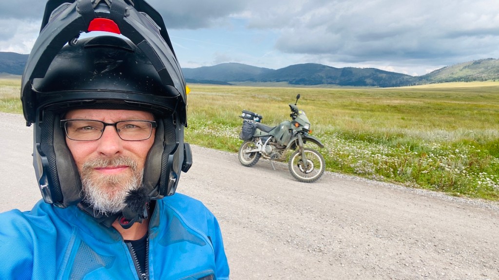
I made a late lunch and let Lister roam around a bit. With the trees behind me directly to my north, Starlink wasn’t going to work, but both of my hotspots had adequate service, so getting online the “old fashioned way” was no problem. Rather than head back into town, I decided to explore the fun, twisty road away from Los Alamos on the bike.

A bit down the road I stopped and looked at the spectacular view across this field. Reading the signs taught me that this was a caldera, created one million years ago by a volcanic eruption 500 times as large as Mount St. Helens. When the magma below flowed out into the surrounding landscape, the land above it collapsed, forming the massive depression that forms this field today. I saw a couple of trails leading out across it, but they were fenced off. It would’ve been fun to ride my bike across a caldera.
And then I did! A few miles down the road was the entrance to the Valles Caldera National Preserve. I rode to the visitor’s center in the middle of it, but didn’t investigate getting a backcountry permit to explore further. It was already mid-afternoon, so I wouldn’t have very long to explore anyway. So I dodged some prairie dogs on the way out, then moved on. It was still cool to have ridden across an extinct volcano.


It was a fun, twisty ride the rest of the way to Jemez Springs, where I found the Jemez Historic Site. These ruins date back 700 years. I’m once again amused at my Massachusetts education that taught me the Pilgrims were the first European settlers in North America. This is clearly untrue, because the Spanish were long since established in modern day Mexico and the southwest US (which used to be Mexico) by the time the Pilgrims arrived in 1620. And, of course, the Natives were here thousands of years before that.
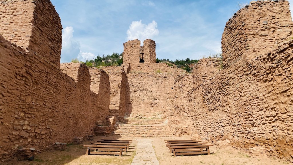
This is the inside of a large church (same one as in the top photo) that was built between 1621 and 1625. The Spanish said “We built a church for the native inhabitants,” while the Jemez people said “The Spanish made us build this church for them that we didn’t want.” Indeed, the Jemez eventually revolted against the Spanish and drove them out for a while.
The construction is interesting. On the surface, it looks the same as the surrounding ruins, because it uses the same stone and mud construction that works well in this area. But the design of the church was clearly European. It was not just a place of worship, but a place that could be well defended. I didn’t get a picture of one of the windows through the thick walls, but the narrow outer opening widens toward the inside, allowing someone with a bow or a musket a wide range of fire while remaining protected inside. I’ve seen this design in old forts and replica castles I’ve visited, while my experience as an SCA archer revealed the wide angles I’d be able to shoot from this window.
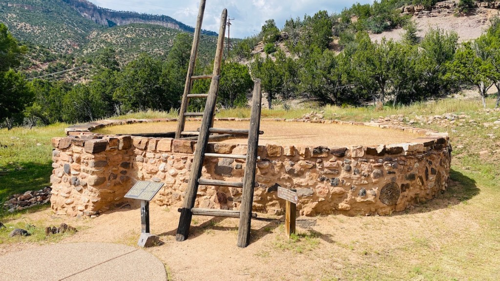
Back to peaceful purposes, this is a restored kiva, which was used for ceremonies and social occasions. They’re sacred spaces and photography is not permitted inside, a request that I respected. You can see drawings of the inside here. I did climb down there, though, which is allowed. Spiritual purposes aside, I could see how an underground space like this would remain a comfortable temperature almost year round. Being underground keeps it comfortable on hot summer days, while a fireplace near the entrance would keep it warm in winter, and smoke would simply rise out of the ladder opening.

I also wandered around some of the ruins near the church. This is the actual height of one of the doorways. I’m not standing on top of anything. It really is that short. I’m six feet tall, so the people who lived here, Native and Spanish alike, must have been quite a bit shorter than today, where my height is just to the tall side of average.
After exploring everything, I hopped back on the bike and rode back to camp, barely missing the rain and thunderstorms that raged on and off all night. I’d had all these adventures just within a 30 mile ride from camp. I didn’t plan any of them. I just stumbled across them as I cruised along. There’s a fine line between planning enough so that you know you’ll have a safe place to spend the night, and planning so much that you don’t get random opportunities like these to explore. Sometimes, the best plan is no plan at all.
