

Seeing the Grand Canyon has been a bucket list item for me for a long time. I missed my opportunity last year while doing Route 66. Late October was already too cold overnight, and one of our group wasn’t handling the altitude well, so we bypassed it and headed straight for the lower altitude in Kingman. It was still too cold to visit when I left the Quartzsite area this spring, but right now the weather is absolutely perfect. I’m traveling alone, making my own plan, and now is the time.
Years ago my dad took an airplane tour of the Grand Canyon while out here for work. It’s so huge that seeing it by air makes a great deal of sense. You can only see small parts of its 277-mile length from the ground. One great thing about this life is that I live so inexpensively, I can afford to occasionally splurge for something special. Today was one of those times. I decided to take my first look at the Grand Canyon in one of these.

A second bucket list item of mine has been to ride in a helicopter. As a gearhead and aviation nut, I’ve always been interested, but never had the opportunity. There are multiple companies in the area offering helicopter tours of the Grand Canyon, so splurged for one with Maverick Helicopters. With the 45-minute tour just a few dollars more than the 25-minute one, I went for the whole enchilada. I also spent some quality time with my phone, transferring and deleting old pictures and videos to make absolutely sure I didn’t run out of memory during the flight.
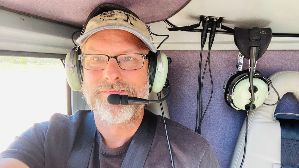
It was a short ride to their facility next to the airport. They’re helicopters, so they don’t need a runway to take off and land. Check-in was easy, and they kept my riding gear safely behind the counter for me. The pilots called us by name, gave us the safety briefing, and then we “got to the choppa,” as Arnold Schwartzenegger said. To get the full effect of what was running through my head at the time (including the soundtrack), I recommend watching the video.
After we took off, we headed east across Kaibab National Forest. This was a good chance for me to see a few of the forest service roads I could ride on later. The pilot noticed and commented on my riding boots. He knew exactly what I was talking about. He also pointed out all of the dispersed camping available out here. We didn’t fly over my camp, but I saw quite a few from the air.

We turned north to head toward the Grand Canyon itself, crossing Route 64 which follows the South Rim for more than 20 miles. That looked like a fun bike ride for later. But I stopped thinking about motorcycle rides as soon as we crossed over the canyon.


Before long we were a mile above the Colorado River rather than a few hundred feet above the forest. It’s a completely different ecosystem inside the canyon, a desert rather than the forest above, and about 20º warmer. People hike from one side of the canyon to the other, but I’m in nowhere near good enough shape to do that. I’ll settle for flying.
We did have a few seconds of excitement here, an abrupt evasive maneuver to the right. A pair of military helicopters were passing through the canyon heading right toward us. These tours take a very established flight path, specifically to avoid close encounters like this, with so many tourist aircraft buzzing around the canyon. Between the flight paths and radio communication, everyone knows where everyone else is and where they’re going at all times. These military helicopters completely ignored that. They didn’t even make any radio calls announcing their presence and intentions as they’re supposed to, which is why our pilot had to react so quickly. It wasn’t a good situation, but our pilot handled it perfectly. I never felt unsafe, just a bit startled for a second by the hard right turn.
On the east side of the canyon, the Colorado River, flowing from the north, makes a sharp turn to the west. Beyond the canyon is the Painted Desert, part of the Navajo reservation. I saw a tiny glimpse of it while visiting Petrified Forest National Park, but nearly all of it belongs to them. We didn’t go over there.

Instead, we made our way over to the North Rim. It’s higher than the South Rim, about 8,000 feet elevation. So while we didn’t fly down into the canyon, we were below the North Rim ground level as we approached, so it felt like we were somewhat inside.

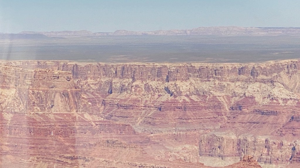
As a science nerd, being able to see the countless layers of rock fascinates me. The light top layer is Kaibab Limestone, deposited when this area was at the bottom of an ancient ocean. Different levels of limestone, sandstone, and shale are visible as you go down, all the way to the Vishnu Basement Rocks at the bottom. This is an igneous rock formed more than two billion years ago, half the age of the planet itself, and the bedrock of the North American continent. You don’t get to see that much.
A fault line runs right through here, and between 70 and 30 million years ago, the land lifted thousands of feet to the plateau where it is today. It was a slow, gradual lift, which preserved the horizontal layers of rock instead of breaking them up. Only five million years ago did what we now know as the Colorado River form and make its way through here. It’s been cutting its way through the countless layers of rock ever since, all the way to the Vishnu Basement Rocks.

Yet it only took a minute or so to fly from there over the North Rim. The geography here is obviously different from inside the canyon, but also quite different from the South Rim just a few miles away. It’s a 200-mile side trip to drive around the east side of the Grand Canyon, north almost all the way to Lake Powell, then south again to get back here. I appreciate the opportunity to do a little aerial reconnaissance before deciding whether to take that trip myself or not. It’s much less developed than the South Rim side, which may or may not be something I’m looking for right now. If I’m going to go, though, I should visit soon. Because it’s higher, it’s also cooler than the South Rim, and may soon get colder than I’m willing to tolerate. Right now, though, the weather is almost identical.

Crossing back over the canyon was no less impressive than the first flight over it. There were many views, such as this one, where you can see every geological layer the canyon has to offer, all the way down to the continental bedrock. While the Colorado River will continue to carve, it won’t expose any more rock layers. This is it, and it will only expose more of it as time goes on. At least, unless the Colorado River stops flowing at some point, which isn’t impossible given the water use and shortages all up and down it.
After a short hop back across Kaibab National Forest, we made our approach around Tusayan. It felt like a small town when I drove and rode through it, but from the air, it’s practically a postage stamp, smaller than the airport itself. It’s pretty clear that the town’s sole purpose is Grand Canyon tourism. That’s just fine by me. The next thing I knew, it was all over, with a safe, soft landing back where we’d started.

If you have the money to spare, I highly recommend seeing the Grand Canyon by air. A helicopter or airplane is your choice — just make sure it’s a high-wing airplane so that low wings, like on an airliner, don’t block your view below. You don’t even have to drive all the way out here to do it, as there are flights out here from Las Vegas and elsewhere. I’m far from done with the Grand Canyon myself, but this flight is an experience I’ll never forget, and was worth every penny to me.
