

Garmin has an “Adventurous Routing” route planning option, which takes you on twisty, hilly roads instead of the direct route. My friend Bob calls these “Squiggle Roads,” which I like much better than Garmin’s name, and have adopted for any such roads whether Garmin plans them or not. I was looking on Rever to find some fun roads beside the famous ones I’ve been riding and quickly came up with a loop of nearby squiggle roads.

You won’t find these on any website about the area. These aren’t named routes like the Tail of the Dragon. It’s just a loop that I came up with myself using Rever. I figured it would also be a good test of the app on my phone. Since there seems to be no cellular data service anywhere in the area, I downloaded the route while I was on the campground’s WiFi to make sure I could keep navigating after I left.
It was a fun route, spoiled somewhat by the poorly functioning app. As soon as I left, the written directions hung, telling me to turn left on Tellico Plains Road for the next two hours. At least the mileage countdown to my next turn, whatever it was, remained accurate. The spoken directions were inconsistent at best, sometimes telling me to take a turn I was already passing, and other times giving me nothing at all. At least that little blue line on the map remained consistently accurate. It was the only thing that did. Rever’s route planning is pretty nice, but I’m quite disappointed in the app itself.
As I turned left onto the southern leg of the route, US 64 and 74, I found myself behind an older man on a scooter. Reading that, you probably think he was going slow and holding me up for this part of the trip. Nothing could be further from the truth. This guy was cooking! There are some scooters out there with 650cc engines, the same as my V-Strom. But power aside, this guy knew exactly how to take the corners, so I had a lot of trouble keeping up with him. There were times he’d even pull away from me. Finally, we got to a long, straight, uphill section where the road split to two lanes, and he slowed down. Only then was I able to pull up next to him and give him a great big thumbs up.
The next morning, I made my way out to US 411, and actually spent an hour or so on long, straight highways. This was a means to an end so I could ride part of the Foothills Parkway. The story goes that Tennessee was disappointed that the Blue Ridge Parkway didn’t extend into the state, so they went to the federal government to get a similar parkway of their own. The Foothills Parkway is the result. Unlike the more famous Blue Ridge, it’s severely lacking in funding, to the point where even now, 75 years after it was approved, construction still isn’t complete, even though the National Park Service already owns all the land it needs.
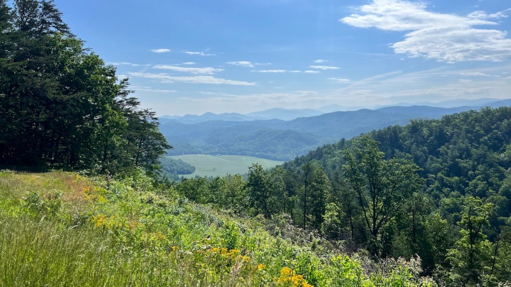
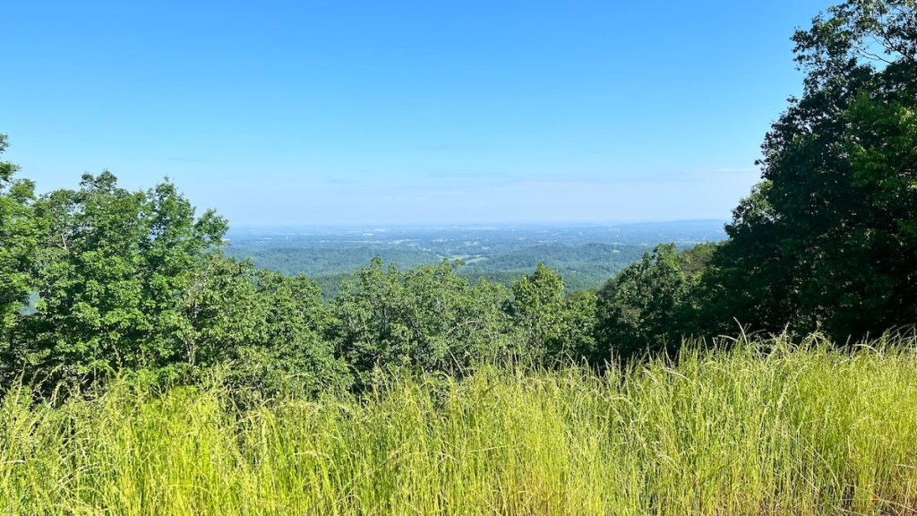
I rode the oldest section of the Foothills Parkway, from US 321 in Walland down to US 129 near the Tail of the Dragon. There’s nothing technical or challenging about this ride, and that’s okay. It’s a quiet, beautiful trip through some great scenery and amazing views at the overlooks — if you spot them in time. While overlooks on the Blue Ridge Parkway are well marked in advance, there are absolutely no signs for them on the Foothills Parkway. They probably don’t have enough money for them. Fortunately, on a bike, I can slow down pretty quickly for most of them.
The section I rode was only 17 miles but involved an hour-long side trip to get to it. It was definitely worth seeing and reminded me of my Blue Ridge Parkway adventure two years ago. It looks like my journey will be taking me away from the Blue Ridge this time around, which is fine by me. My previous desire to repeat and complete the Blue Ridge has faded. This is my adventure now, and unfinished business from my previous adventure doesn’t bother me anymore. Besides, the campgrounds along the Blue Ridge not being open until Memorial Day weekend have made the logistics of where to stay just about impossible this time around. So, like Tennessee, I’ll settle for the Foothills Parkway as a consolation prize.
For this route, I went back to Google Maps and figured out how to download an offline map of the area. I was hoping this would allow me to keep and even switch sets of directions as I cruise around this area with no cell data service. I’d planned two routes for the day. One would take me back to the campground after the Foothills Parkway. The other would take me down the Tail of the Dragon and up the Cherohala Skyway in the opposite direction I rode them the other day. It was only 10:00 am, so I decided to switch to the long route. Despite having the map downloaded, Google utterly refused to calculate the route without cell service. How annoying!
Fortunately, I already knew that at the other end of the Tail of the Dragon I could stop at the Deals Gap Motorcycle Resort, connect to their WiFi, and get the rest of my route there. Still, I can’t understand why two different apps that give you the option to download maps and use them offline don’t actually work offline. This is the one, and only, area where a Garmin GPS is superior. But it doesn’t have to be this way, if only they’d design the apps to truly work offline.
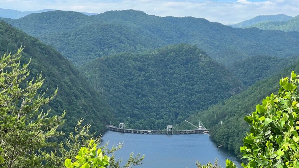
I just made the one run down the Dragon this time. I even pulled off at the overlook to take in the scenery. I’m glad I did. Normally I’m having too much fun with the curves to think about it. It was a particularly quiet morning, even quieter than Tuesday, so I got an almost completely clean run without traffic. I had to slow down for a Ford Edge for a couple of curves, but it let me by. Then I pulled over and let by the only bike fast enough to catch up to and pass me on all my runs through the Dragon this visit. It was a Kawasaki KLR650. You know, the bike I sold because it wasn’t fast enough on the pavement. I might as well quit motorcycling right now. Nah — it’s too much fun, even if I’m not the fastest or most skilled rider. I’m certainly not as skilled as this KLR rider, who easily caught and pulled away from me on a bike with nearly half as much horsepower as mine.
Google took me down a fun route through the Nantahala National Forest that I hadn’t seen on my last visit. It was another quiet back road with sections just as challenging as the Dragon, but with no traffic at all because people don’t know about it. It was fun and connected me directly to the east end of the Cherohala Skyway, which I followed back to camp. The sky was getting cloudy, and I knew there was a chance of rain in the afternoon, so I didn’t waste time getting back. I saw maybe three raindrops all afternoon.

This place is starting to fill up before the weekend. People keep telling me about this group of KLR people who come each year on this particular weekend. Most of them don’t ride KLRs anymore, so I’m fitting in just fine. They’re definitely more dirt riders than I am right now, though. While my bike could handle the easy dirt around here, my tires are meant strictly for pavement. After the heavy rain earlier this week, I’m sure those roads are sloppy and muddy, so I should stay away from them for now. I’ll just have to come back someday and do some dirt exploring with more appropriate tires. In the meantime, I’m enjoying getting some use out of what I have on the surface it’s meant for.
