

Saturday was yet another windstorm. Nothing happened.
Sunday was my last day off work before I’d be hitting the road again later this week. Death Valley is nearby. It seemed like something I should go see while I’m in the area. So I topped off the KLR’s large gas tank (services are few, far between, and expensive out there), and hit the road.

I took the long way there, out Highway 372 from Pahrump which becomes Highway 178 in California to the town of Shoshone. There are a few hotels and RV parks cashing in on the hot springs in the area, and that’s about it. This route would put me south of Death Valley National Park, and take me through some fun twisty sections as I made my way toward the more popular areas.
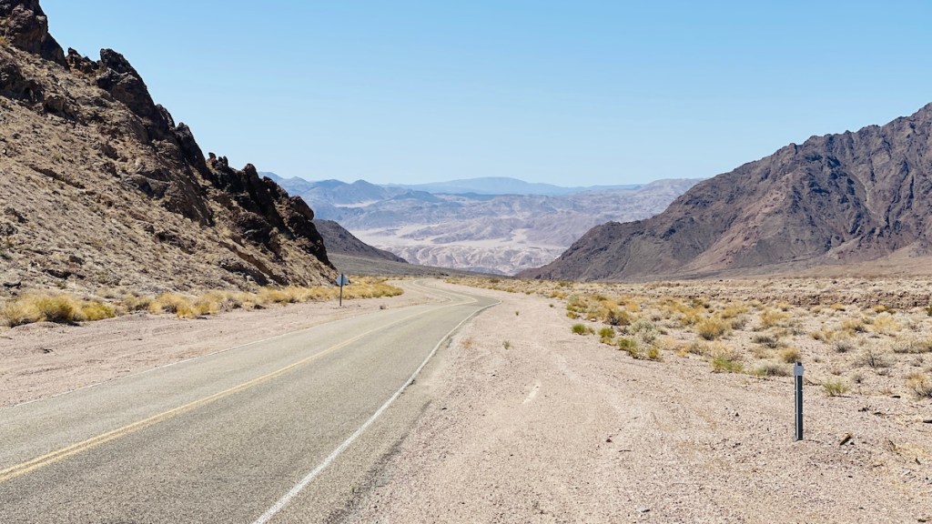
Views like this greeted me around every curve and over every hill. The KLR struggled a bit to maintain the 65 mph speed limit on the steeper sections heading up over Salsbury Pass at 3,315 feet. I dropped a gear and dropped some speed, and we got there.


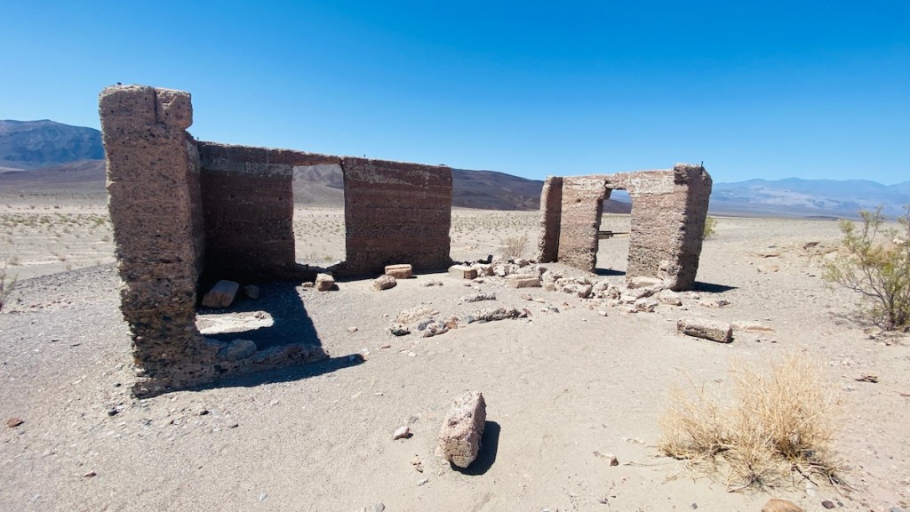
I paused at the Ashford Mill Ruins, the remnants of an old mill that processed gold from a mine five miles away. This is all that remains of a concrete office building. There are also some foundation remnants from the old mill. The story goes that the Ashford brothers sold $50,000 worth of gold that they mined here to a Hungarian count. The truth is the mine and this mill were just too expensive to operate as compared to how much gold they actually produced, which is why they were abandoned in 1941.

When I tried to leave this bird was hanging out next to my bike. It didn’t move until I started the engine. I had to be careful not to kick the bird as I got on the bike.

Badwater Road hugged the east side of the valley, winding its way around the edge of the salt flats in the middle. Numerous signs along the way reminded me not to leave the paved or dirt roads. While the KLR could certainly have handled an off-road excursion here, I obeyed the signs to preserve the natural environment. Besides, I don’t need to make a top-speed run. I already know it maxes out at 85.

Soon, I hit a real low point in life. Literally, 282 feet below sea level, at Badwater Basin. (Also, that’s 85.5 meters, not 855. There’s a poorly placed decimal point that makes the metric number look wrong, because America.) There’s a tiny pool of water here, which can expand into a small lake during a rare rainfall.


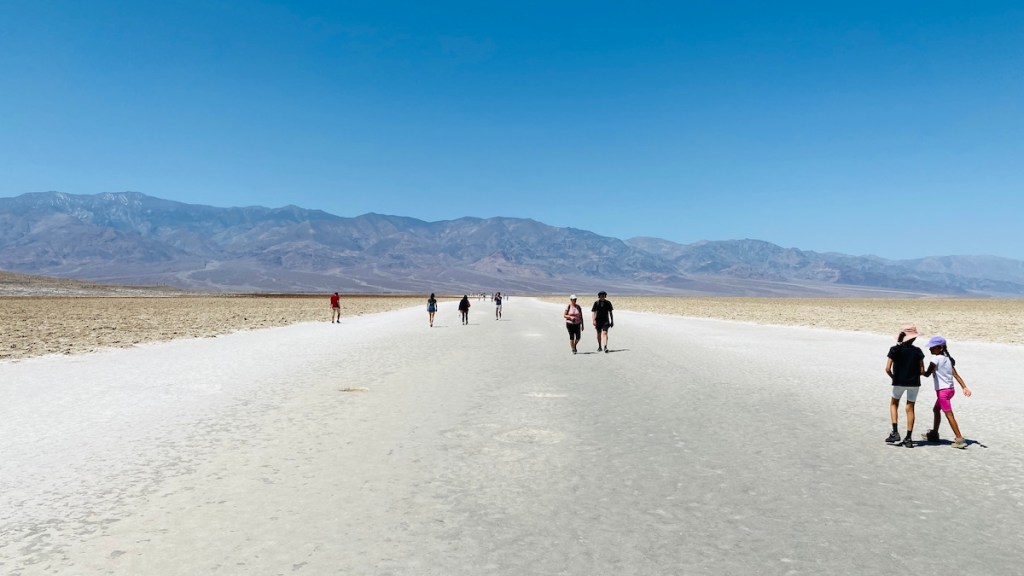
Here you can walk out onto the salt flat (still no motorcycles allowed, though). Finally, I understand why racers at Bonneville find this surface so appealing. There’s not as much traction as pavement, but it’s still rather good, like hard-packed gravel but smooth. The fact that it stretches for miles means there’s nothing to run into at high speeds out there.
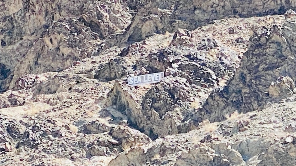
This sign, high above on the side of the mountain, gives you a great visual representation of just how far down you are. I’ve been living at 2,700 feet in Pahrump, Nevada for the past two weeks, and I definitely enjoyed the thicker, more oxygenated air in my lungs. Even my carbureted bike seemed to run better.

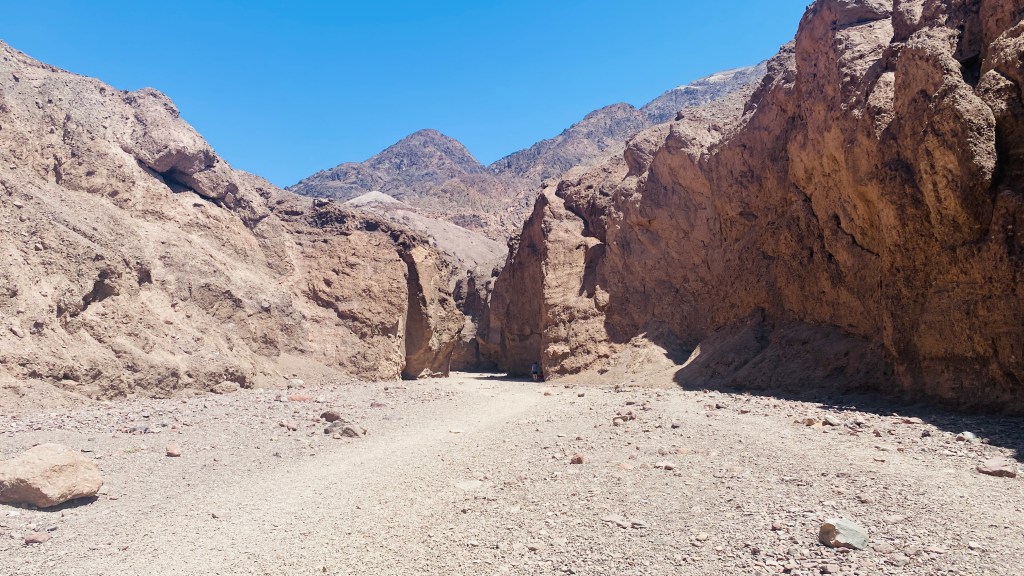
Moving on down the road, I came to a turnoff toward a natural bridge. From looking at the map, I remembered it wasn’t far, so I decided to go check it out. The road was dirt, but fairly smooth, easy for a KLR.


Soon I got to a parking lot and walked 1/3 mile up a trail to see the bridge itself. The hill was steeper than I expected, and despite the thicker air I had to stop and catch my breath a couple of times. I’m sure that’s more a reflection on how out of shape I am than on the difficulty of the trail.
The bridge was pretty cool. I remember another natural bridge in North Adams, Massachusetts where I went to college. It was nothing like this, but both are pretty neat rock formations.

The walk back was much easier, being downhill. It also had some amazing views across the valley.
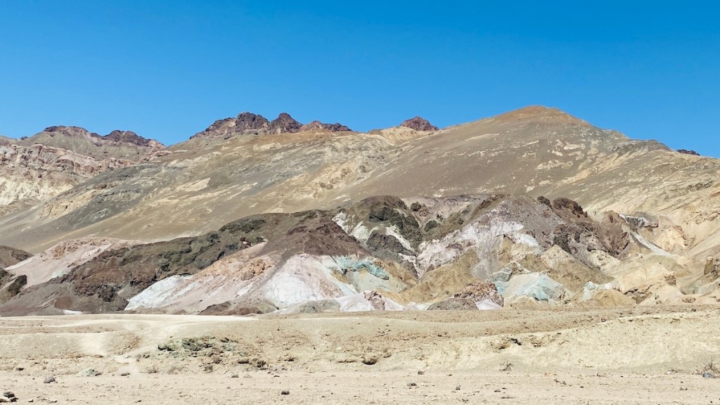
I also took a small loop off the main road past the Artists Palette. This is a series of brightly colored rocks and hills that look like what they’re named. The bright colors come from various mineral deposits in the rocks. This road is narrow and one-way, so I had fun using the entire width of the pavement through the curves, like on a race track. But I set no speed records.

My “destination,” at least for the purpose of navigating a route, was the visitor center in Furnace Creek. This sign outside accurately described the 3ºF temperature difference for every 1,000 feet of elevation. People in van life are intimately familiar with this since it’s how we put ourselves into comfortable temperatures without necessarily traveling very far. When it got hot in Quartzsite, for example, I came to Pahrump, where it’s about 10º cooler. The indicated temperature of 91º didn’t feel too bad at all. I was wearing my mesh riding gear, so ventilation was excellent while I was moving. Also, as the saying goes, “it’s a dry heat.” I had no build-up of sweat at all because the air was so dry it probably evaporated just as quickly as it formed, keeping me cooled off.
I explored the visitor center a bit. I also bought a sticker for the van (it counts — it doesn’t matter that the van didn’t go there, only that I did), as well as a hat because I liked the petroglyphs on it. Then I returned to my bike, appreciating the ability to park in the shade so the seat wasn’t too hot to touch.
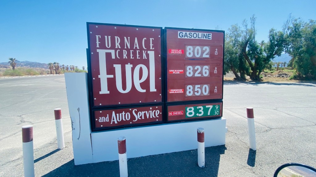
If you think gas is expensive where you are (at least, in the US), here’s a rude awakening for you. California gas prices are high, but not usually like this. It’s literally the only gas for more than 50 miles, so they can charge pretty much whatever they want. Fortunately, my KLR650 has a 6.1-gallon gas tank, which meant that I could do this entire loop on a single tank without paying ridiculous prices. My Honda PC800 couldn’t have done that with its smaller tank.
I set a course back to camp, which, at 61 miles away, was a much shorter route than I’d taken to get here. It wasn’t as scenic, interesting, or steep as the route through Shoshone, which I was glad I’d taken earlier. This route was easy, though, and with the high speed limits across the desert (I could literally see my next turn five miles ahead of me) I got back to Pahrump pretty quickly. I did stop to refill the gas tank as I got back into town. I’d traveled 169 miles since leaving, and avoided $8/gallon gas thanks to my large fuel capacity.
I settled in back at camp, gave Lister some outside time, and hung out with campmates and visitors from other camps for the afternoon. We also spotted Bob Wells driving off into the nearby desert to go camp by himself. We didn’t pursue him, though I did see him making a video next to the big dumpster that BLM had provided for a HOWA cleanup on Friday. I’ll have my own video about that soon.
