
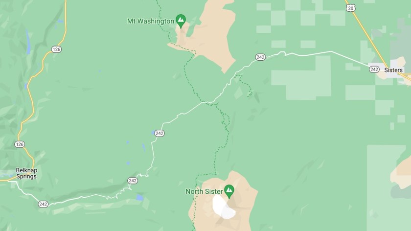
When I announced that I was staying in Sisters, my friend Glen asked me if I’d ridden Route 242 yet. I’d just arrived, so no, I hadn’t. When I looked at the map, it looked like a toddler had scribbled all over it to create Route 242. Immediately I knew I had to ride it.

I had to pull over as soon as I hopped on 242 in Sisters to take in this view. These are the Three Sisters, for which the town is named. Each is around 10,000 feet tall, and each is a dormant volcano. The snow on top (yes, even at the beginning of July) is what remains of the glaciers that used to cover this area. They’re slowly shrinking as the planet’s temperature increases.
The road continued straight and wide for a while. Then warning signs appeared prohibiting any vehicles longer than 35 feet. It got quite narrow and twisty after that. With no posted speed limit, the state default of 55 applied, but there were many sections where I couldn’t possibly maintain that pace. I didn’t even try.

Soon I entered the WIlliamette National Forest, straight into yet another burn zone from forest fires. All over Oregon, I’ve seen these “$500 penalty for throwing away burning materials” signs. They’re serious, and this is exactly why. While this spring was insanely wet, vastly reducing the risk of wildfires, there’s been a big risk of wildfires in recent years, when some of these took place. Keith, one of my Cottage Grove friends, told me that he wasn’t even allowed to mow his lawn last summer, because a spark could’ve set one off.

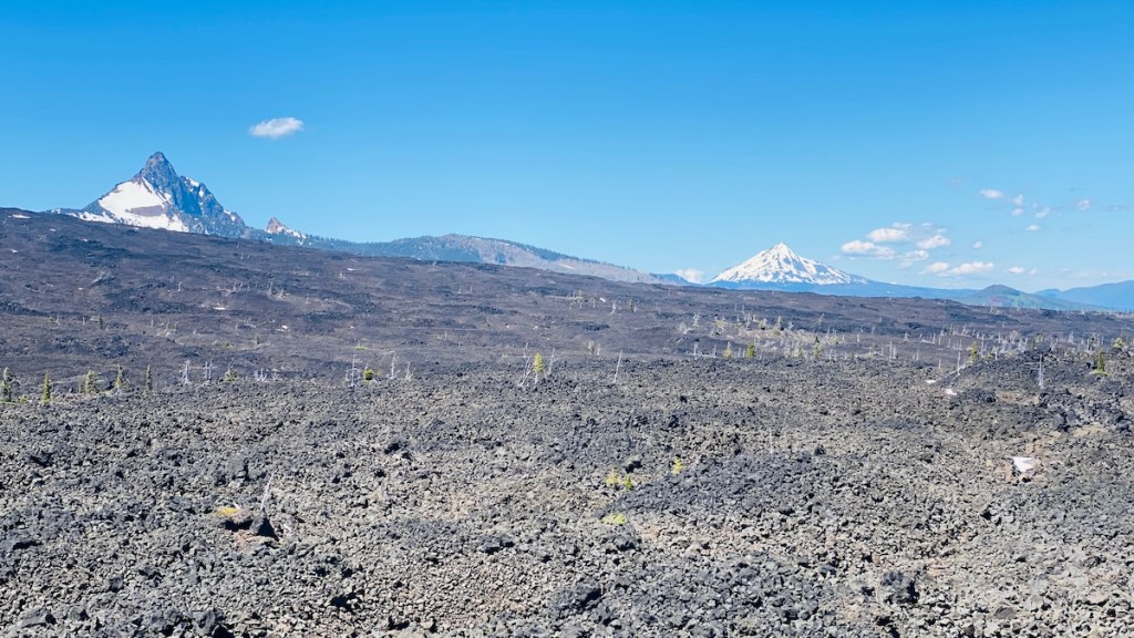
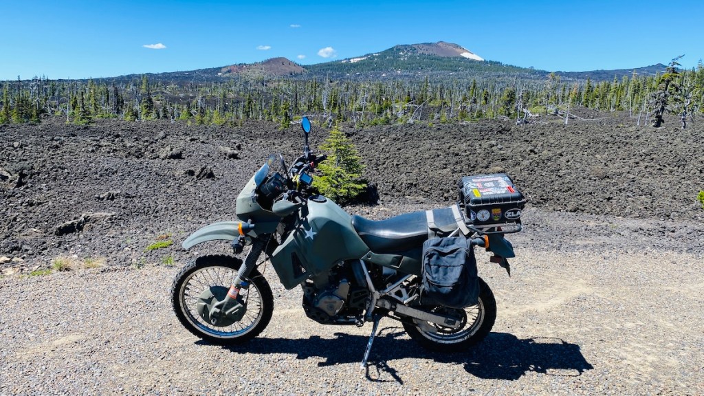
I came around a corner and did not expect to see the forest, or at least what’s left of it, turn into a vast field of volcanic rock. According to the signs I read, the eruption that created this happened fairly recently, about 2,000 years ago — a blink of an eye in geologic terms. That’s Mt. Washington (no, not that one) on the right. I continued riding, constantly switching between the apocalypse environment of a wildfire aftermath to the apocalypse environment of lava fields. It’s a good thing I was on my trusty apocalypse motorcycle for this.
It was a slow climb, both because of the steep hills, and also because my engine was losing power at the higher elevations. Because it’s carbureted, not fuel injected, it can’t adjust to the thinner air at higher elevations automatically. The air/fuel mixture that’s best for sea level doesn’t produce as much power at higher altitudes. I topped out at 5,325 feet, the highest point of McKenzie Pass.

The Dee Wright Observatory was also here, built entirely out of the rocks that scattered the landscape. I could see several mountains all around me from the parking lot, so I had to climb up and check out the observatory for myself.
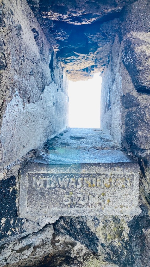
Inside there was information about the observatory, as well as the history of travel across the Cascade Range. The walls had several windows, including numerous small portholes to view each of the mountains and other features of the landscape in the surrounding area. My pictures inside didn’t turn out well because of the vastly different amounts of light inside and out, but you can get the idea. Imagine, instead of a wall of light, a crystal clear view of Mt. Washington, which is what I saw. Other viewports pointed at each of the Three Sisters, Belknap Crater (the volcano that created this lava field), Mount Jefferson, and even Mount Hood, barely visible 78 miles away.
That wasn’t all to the observatory, though. I continued up the stairs to the roof.


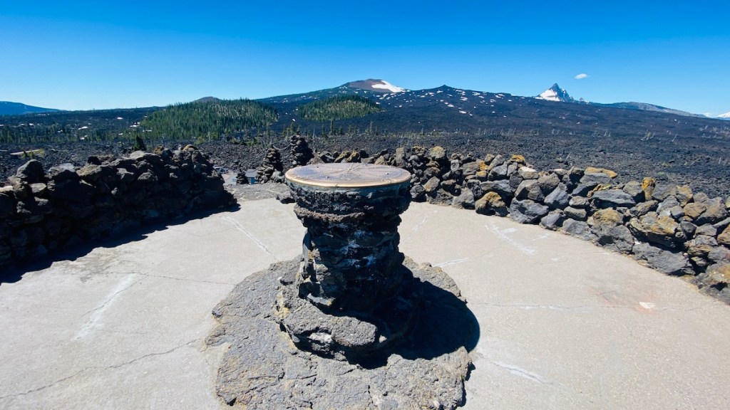

A pedestal in the center points to all of the same mountains and features as the viewports below. After learning what they look like individually, it’s easy to spot them in the bigger picture of the open landscape.
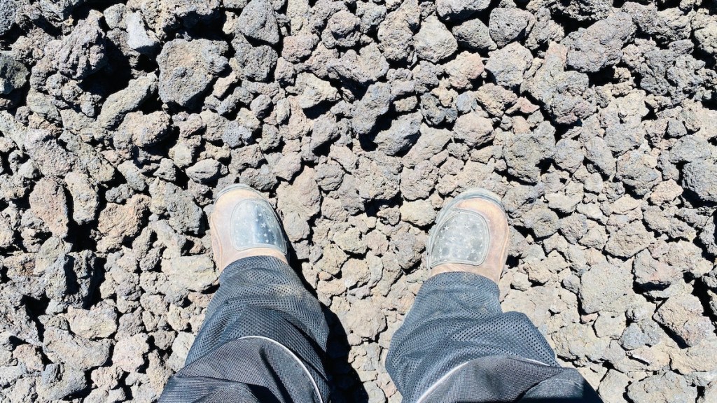

I had to take the opportunity to put my feet on the volcanic rocks. I also enjoy taking pictures of my apocalypse bike in apocalyptic landscapes.
Eventually, I made my way down the other side of the pass. It continued to be tight and twisty, but it was clear that I’d moved into a different environment. Before long the volcanoes and wildfire damage were behind me, and I was back in the forest. As I continued descending, the trees got taller. Eventually, I left my sun visor up because I was completely in the shadow of the trees. I didn’t get any pictures of this part because there weren’t many places to pull over, plus I had enough of a challenge just following the narrow twisty road. That’s not a complaint — I loved it. I just don’t have any pictures to show for it. I’ll have to go back with my GoPro and a couple of batteries to show what all this was really like. It’s worth a second trip just to see it again, as well as to make a video.
The west end of 242 put me back on 126, which I followed back to US 20, retracing the route I’d driven to get to Sisters. While my Garmin said this was the fastest way, it wasn’t nearly as fun and was definitely a longer distance. My KLR was huffing and puffing over another mountain pass just trying to maintain the 55 mph speed limit with traffic stacking up behind me before passing. It was actually a relief to get stuck behind an even slower truck making the climb. At least then I wasn’t pushing the bike so hard, and I wasn’t the one holding anyone up. The bike performed perfectly, as usual, but I wished I’d turned around and taken 242 back to Sisters instead.

Finally, I rolled back into Sisters. I have a lot to celebrate right now, including a promotion at work, so I treated myself to dinner at Three Creeks Brewing Company. This is the Fivepine Chocolate Porter, which I got along with the All-American Burger for dinner and a Crowdpleaser IPA for dessert. All of it was quite tasty. I’m pretty sure I’ll go back for more before I leave the area.
